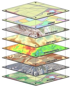
Spatial Data Analysis In R and ArcGIS
Instructor: Jessica Godwin
This 2-hour workshop will introduce the use of R and ArcGIS for both Graphical User Interface (GUI)-based and script-based geographic information systems (GIS) overlay analysis workflows. By the end of the course you will be able to understand the pros and con’s of using both R and ArcGIS for spatial data analysis.
Outline |
|
Materials |
ArcGISPro Lab: Intro_to_ArcGISPro.pdf R Lab: IntrotoGISinR.html Washington Census tracts: Washington tract-level 2020 Census counts by Race: Sound Transit Open Transit Data GIS Data:
|
Additional Resources |
Instructions for downloading R and RStudio: Request a Census API Key: |