Tracking Conflict and Cholera from Space: Using Night Lights to Measure Infrastructure Collapse and Recovery, Population Displacement, and Disease Risk – Dr. Daniel Parker
Posted: 4/9/2025 (CSDE Seminar Series)

When: Friday, April 18, 2025 (12:30-1:30PM)
Where: 360 Parrington Hall and on Zoom (register here)
1-on-1 meetings: 223 Raitt Hall (sign up here)
We are looking forward to hosting Daniel Parker from the University of California – Irvine on Friday, April 18 in Parrington Hall 360 and on Zoom. This seminar is co-sponsored by the Population Health Initiative. In addition, there are opportunities to meet 1-1 with Dr. Parker throughout the day. Sign up here!
Quantifying armed conflict is challenging, as traditional conflict data often rely on incomplete reporting and typically focus on metrics like the number of airstrikes. However, these measures overlook critical factors such as infrastructure destruction, population displacement, and recovery. In this talk, I’ll discuss how my group has been using satellite-based nighttime lights (NTL) data as a scalable tool for tracking conflict intensity and its downstream effects on public health. Using case studies from Yemen and Ukraine, I’ll show that airstrikes lead to significant declines in NTL, with notable geographic and temporal variation in post-attack recovery. In Yemen, I’ll further demonstrate how NTL can help assess the impact of armed conflict on cholera incidence, providing a means to quantify associations between conflict intensity, infrastructure disruption, and disease risk. The analysis highlights how both the magnitude of conflict and the pace of recovery shape cholera incidence. This approach provides an objective, real-time method for evaluating the cascading effects of conflict on infrastructure and health, with critical implications for humanitarian response and global public health.
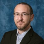
Dr. Daniel M. Parker is trained in anthropology and demography and considers himself a spatial epidemiologist and medical geographer. He works on infectious diseases, human movement and travel patterns, and spatial interventions, particularly in under-resourced and conflict-affected regions. His research integrates geographic information systems (GIS), Earth observation data, molecular epidemiology, and statistical modeling to examine disease transmission and barriers to healthcare. He has led large-scale geographic reconnaissance efforts for malaria interventions in Eastern Myanmar; worked on vector-borne disease ecology in Asia, East Africa, and the U.S.A.; and conducted research on displaced populations’ access to healthcare. Through collaborations with NGOs, governments, and academic institutions, his work directly informs scalable public health interventions, using geospatial technologies to analyze mobility patterns, model disease distributions across space and time, and improve healthcare delivery in vulnerable populations.