Point Patterns and Raster Surfaces
Instructor: Matt Dunbar
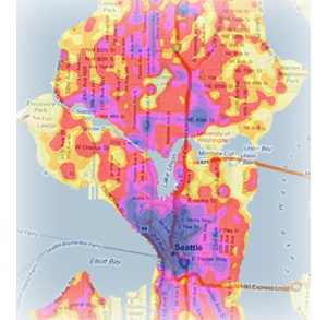
Spatial data comes in many forms. Although much of the GIS research and teaching at CSDE revolves around data describing contiguous polygons (such as census tracts and counties), there are other ways of representing spatial information that are equally important to demographers. This course introduces point and raster data types and some of the tools for analyzing them. We begin with raster data and the basic mathematical transformations where this data type excels. Next, we introduce two types of point data: events and samples, and work through techniques for measuring clustering using data on crime in Seattle. The class culminates with the development of two types of raster surfaces: density and interpolation, which both transform point data to raster form.
Prerequisites |
A basic understanding of GIS, such as our Intro to GIS workshop. Additionally, many of the techniques employed here complement those taught in the Exploratory Spatial Data Analysis workshop. |
Outline |
|
Materials |
|
Additional Resources |
none |