Spatial Data Scripting in Python
Posted: 12/5/2016 (CSDE Workshop)
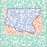
This workshop explores the basic functionality of the OGR python library. This free and open-source library enables users to work with a variety of spatial data formats. This workshop will implement reading and writing shapefiles as well as testing if a set of geographic coordinates are within a particular geographic boundary. Effectively, a point in polygon operation: one of the most frequently used operations when working with spatial data. This method can answer such questions as: Are these study participants in one census tract or another? What neighborhood is each city park within? Are these incidences of malaria in the city center or the outer neighborhoods? This workshop is recommended for people who have some experience programming in python (i.e. basic control flow and understanding the differences between a set, a dictionary, and a list).
Date: 12/07/2016
Time: 11:30 AM - 1:30 PM PT
Location: University of Washington, Savery 117